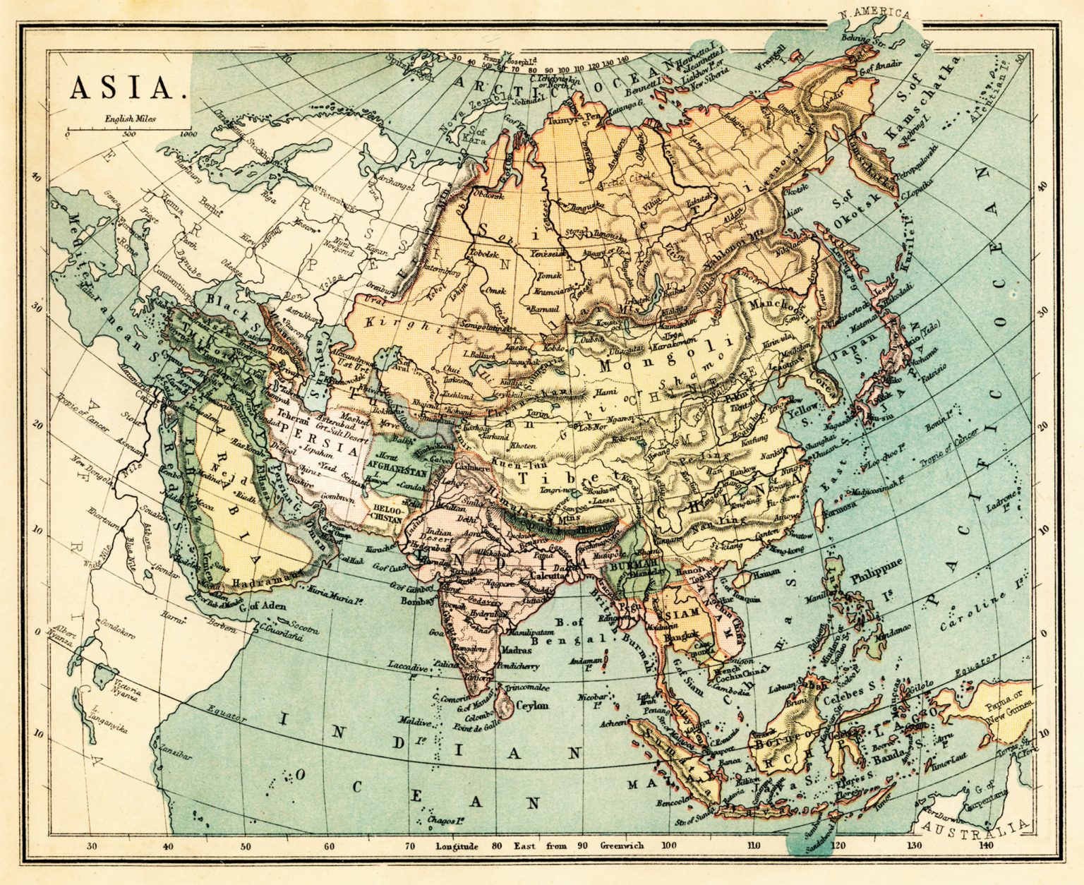
Map of Asia from the Victorian era. Photo: whitemay/Getty Images
Maps that shape today's Iran. Mountain fortress or prison?
Iran lies at the center of one of the world's most important land routes. Mountains, deserts, and ethnic mosaics shape not only its past, but also the chances of the regime's fall or survival.
What will happen in Iran? Will the regime fall? If so, how? What will other superpowers do? To answer these questions, it is important to understand why Iran is the way it is. Two maps reveal a lot about this.
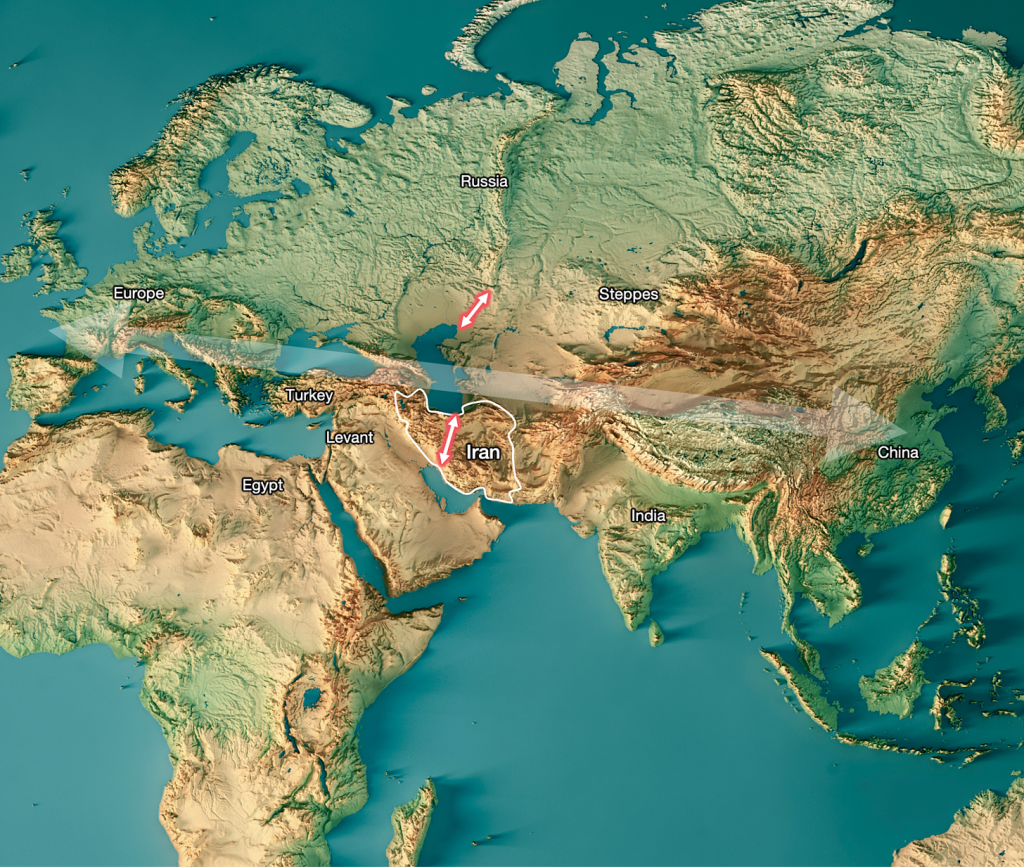
The first shows that Iran lies at the center of a key route from east to west across Eurasia. Throughout its history, it has faced superpowers in the west, such as Babylon, Greece, Rome, the Ottoman Empire (now Turkey), the British Empire, and the United States. In the north, it has faced Russia. In the northeast, the country has experienced dozens of invasions by nomadic peoples, the most famous of which were the Mongols. Today, Israel, Saudi Arabia, and Pakistan must also be added to the equation.
Photo: Tomas Pueyo
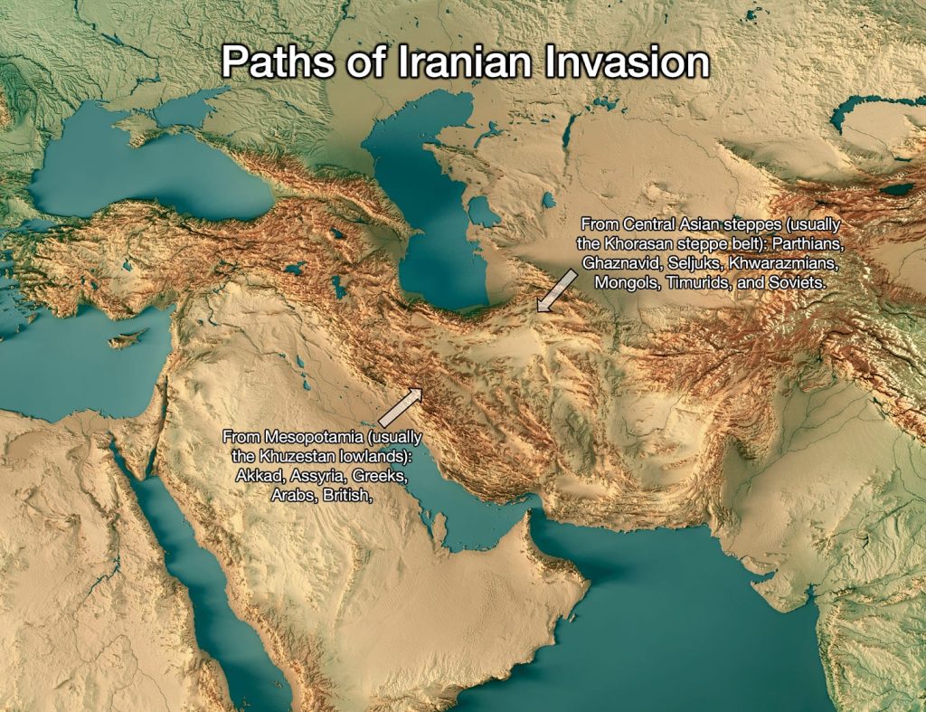
In order for all these civilizations to travel overland from east to west, they must pass either through Iran or through a small gap between the Caspian Sea and the Ural Mountains in Russia (red arrows on the map). Iran is located in the middle of a highway that dozens of powers are interested in controlling.
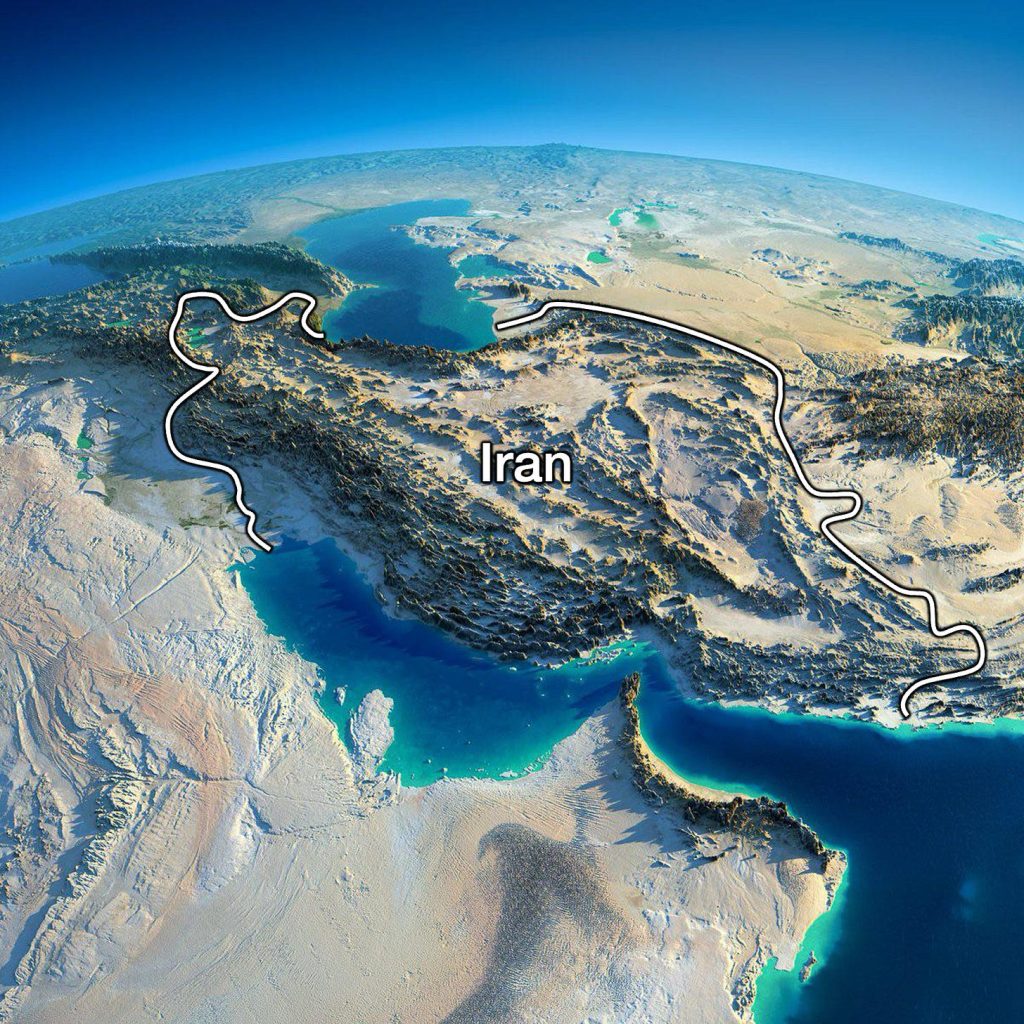
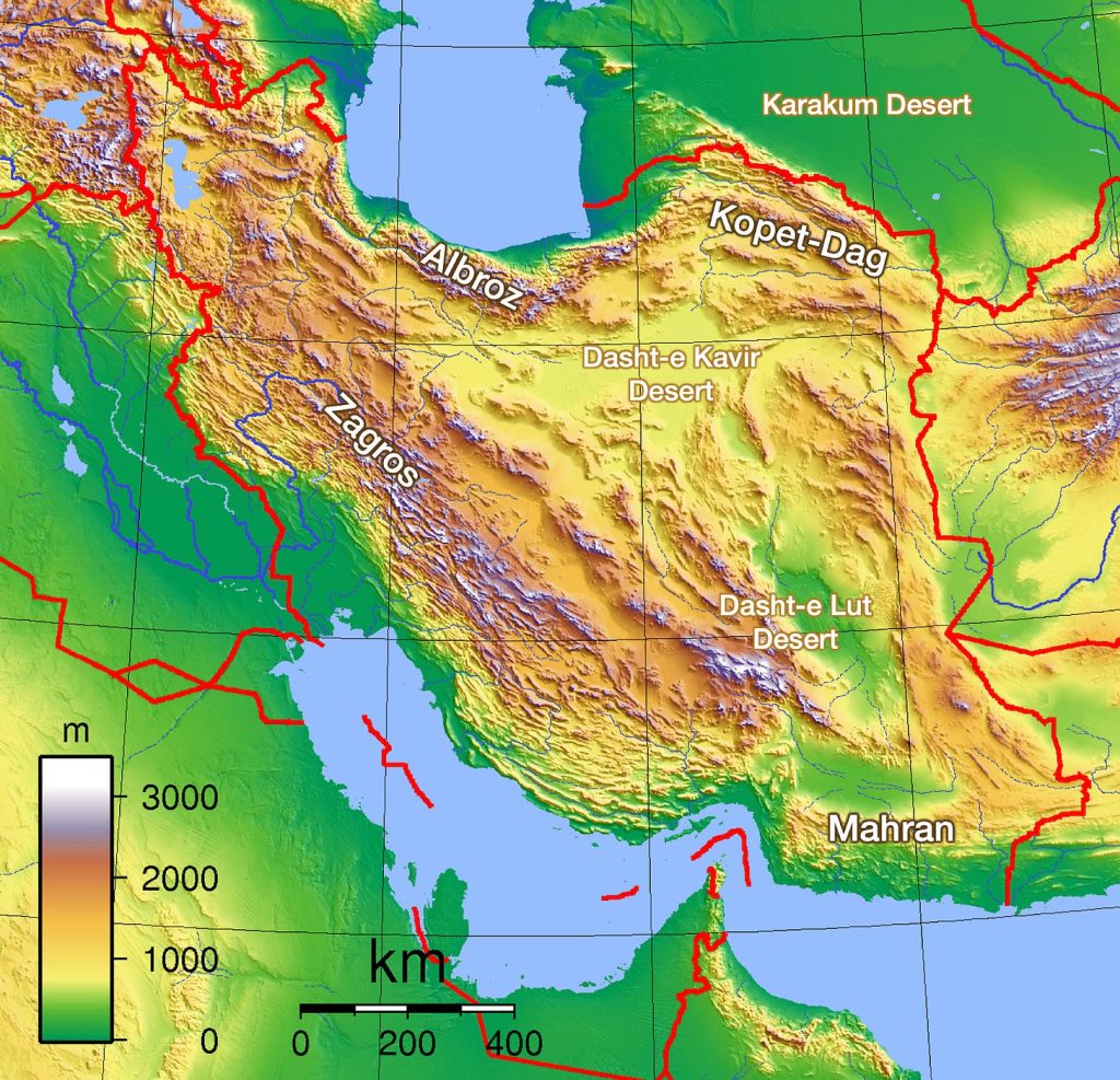
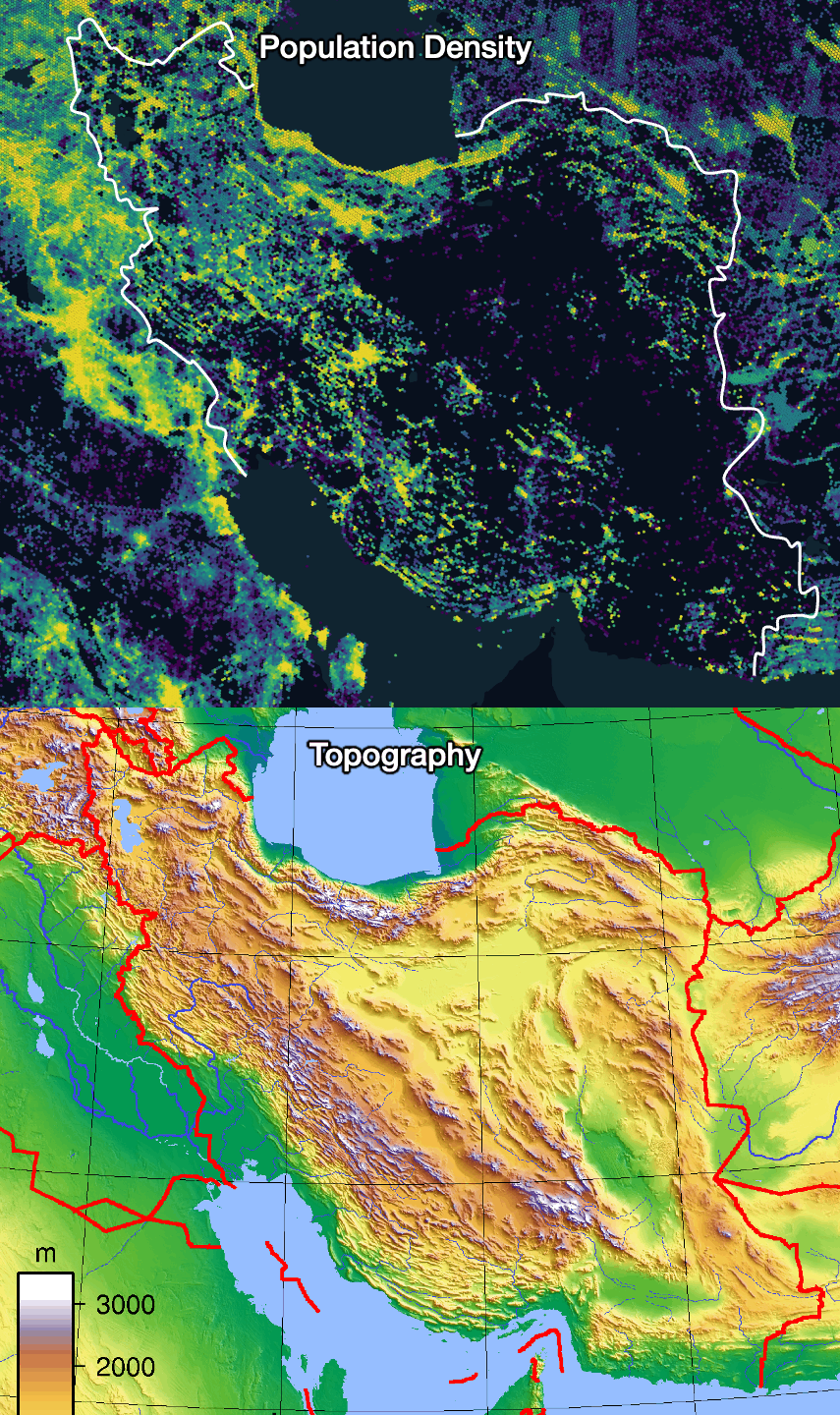
Other maps show a second important feature of Iran—it is a mountain fortress.
Photo: RedditPhoto: Wikimedia
The consequences of these two facts—a fortress in the middle of a highway—have significantly influenced Iran's history. They continue to do so today, and we can expect this to remain unchanged in the future.
A fortress, but also a prison
Although Iran is exposed to external threats due to its location, it is huge. With 1.7 million square kilometers and 90 million inhabitants, it is 70 percent larger and has more inhabitants than Afghanistan and Iraq combined. If it was difficult for the US to control Afghanistan, imagine what a ground invasion of Iran would look like.
Like Afghanistan, Iran is well protected from foreign invaders by its mountains, deserts, and seas.
In the past, the high Zagros Mountains bordered Mesopotamia to the east, one of the first places where civilization arose, as the banks of the Tigris and Euphrates rivers are extremely fertile.
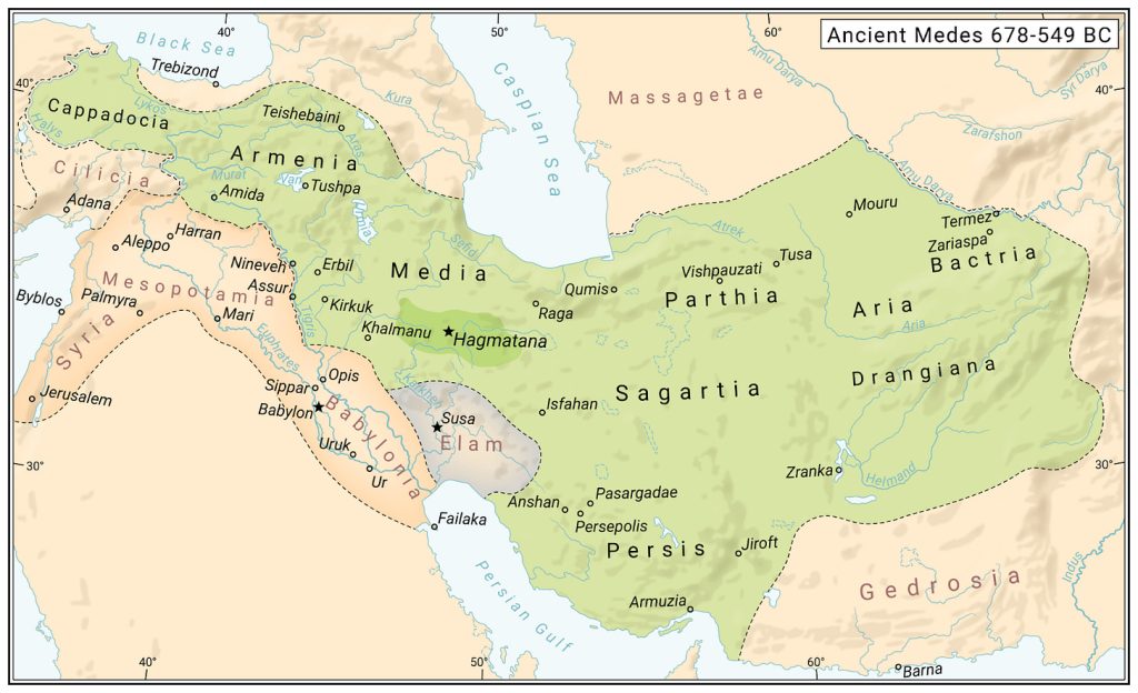
While it was difficult for people from the lowlands to attack across the mountains, it was difficult for mountain people to descend into the lowlands. This dichotomy between mountain and lowland populations was already evident in Babylonian and Median times around 600 BC.
Photo: WikimediaPhoto: Wikimedia
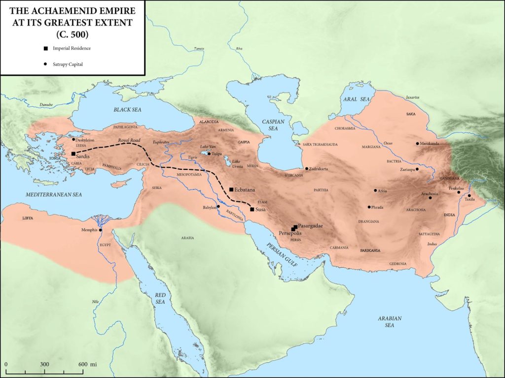
Later, however, Mesopotamia was conquered by the Achaemenids of Persia. Throughout Iran's subsequent history, the Persian mountains and Mesopotamia were often united and divided.
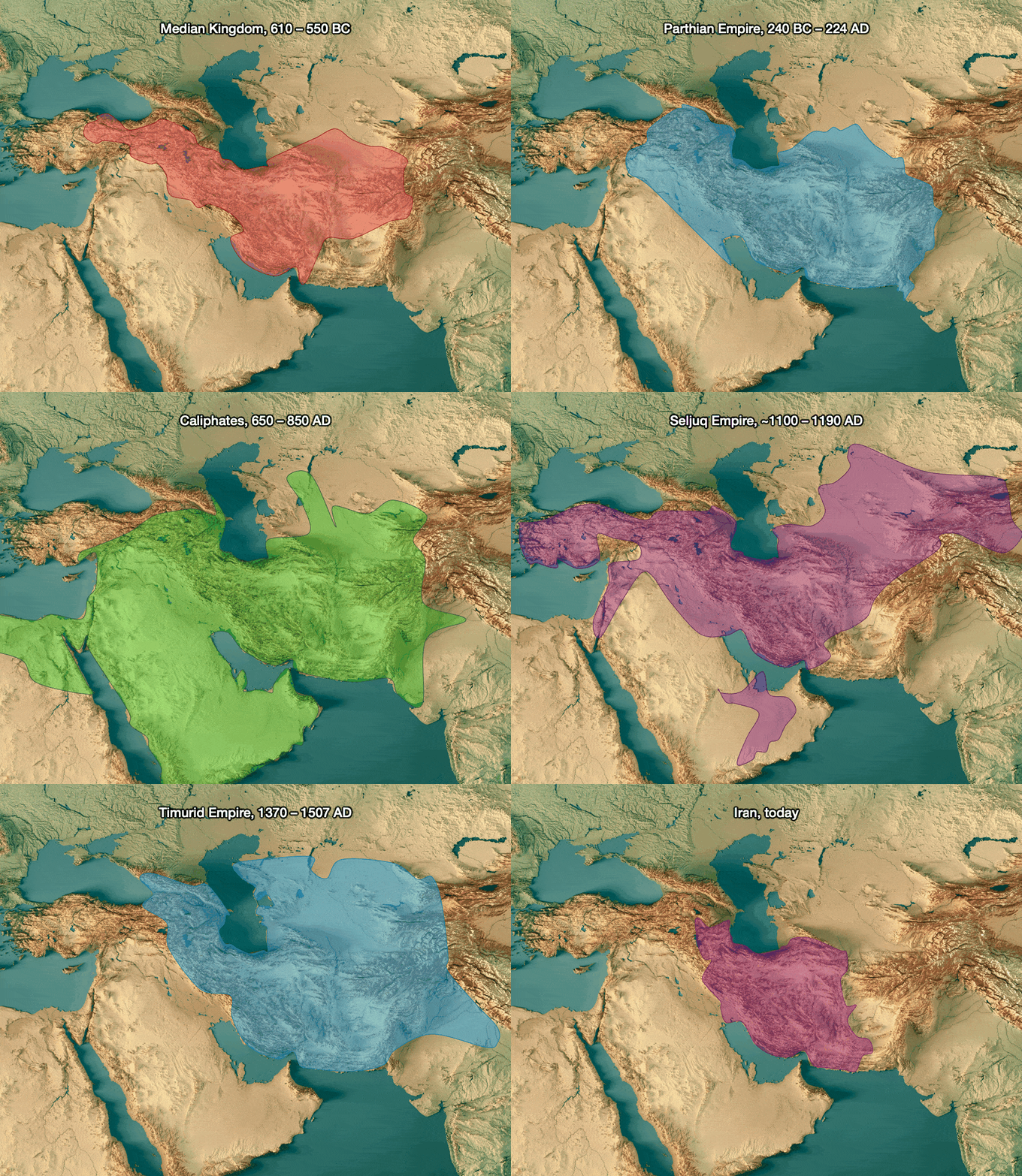
Most of these unions were the result of Persian invasions (Achaemenids, Parthians, Sassanids, Seljuks, Mongols, Safavids), but there were also several attacks from the opposite side.
Iran was attacked on a large scale from Mesopotamia several times – for example, by the Akkadians, Assyrians, Greeks, Arabs, and British during World War II. However, despite numerous attacks, since the Macedonian invasion in 330 BC, present-day Iran has only been successfully invaded from Mesopotamia twice in the last 2,300 years (by the Arabs and the British), and in both cases it faced overwhelming odds.
The Romans tried several times and never succeeded. And 40 years ago, Iraqi President Saddam Hussein also learned that this country is impregnable.
Photo: Truth & Facts
Iran was successfully invaded mainly from the east through the Central Asian steppes. However, these incursions essentially ceased when gunpowder was invented and the steppe warriors on horseback lost their superiority.
The rest of Iran is well protected. To the northwest are the mountains of Anatolia. Further north is the very high Caucasus, which is almost impenetrable. None of these areas are very valuable.
Photo: Tomas Pueyo
The Persians never expanded across the seas to the north (the Caspian Sea) and south (the Persian Gulf) because, given their size and location at a land crossroads, they had to maintain strong land armies.
This investment prevented the development of a strong navy and expansion.
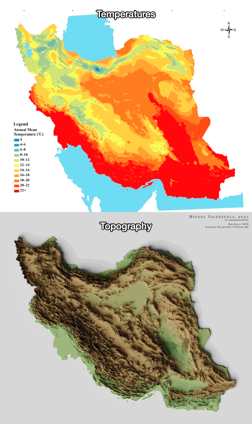
In the east of the country are the Iranian deserts of Dar-e Kavir and Dar-e Lut, where some of the highest temperatures on Earth have been recorded. Behind them are several mountain ranges and then the even higher Hindu Kush mountain range, which form excellent buffers, but at the same time, these are not rich regions. Iran would gain nothing from invading Afghanistan, and the Afghans do not have enough resources to conquer Iran.
To sum up, one of the significant consequences of Iran's geographical location is that, although the country is exposed to foreign attacks and invasions, it is generally well protected, mainly thanks to its mountains and deserts, which are not very rich in resources. The exception is the Mesopotamian region in the west, which makes it the only natural route for Iran's expansion.
Unfortunately for Iran, these mountains and deserts not only protect it but also imprison it. Invasion of its neighbors is a nightmare, as the logistics of large armies across high mountains and large deserts are very difficult. It is no coincidence that so many invasions came from the steppe warriors in the northeast—their nomadic way of life allowed them to travel with food (mainly horses and sheep).
Mesopotamia is close to the west, but as Iran discovered in its eight-year war with smaller Iraq, it simply cannot muster the logistical resources to defeat its neighbor.
The positives and negatives of Iran's mountains
Another consequence of Iran's geographical location is its wealth – or rather its lack thereof.
In the temperate climates of America, Europe, and Southeast Asia, few people live in the mountains because they are too cold and transportation is too expensive. However, thanks to its latitude, Iran is very warm and dry. Temperatures can even be unbearable, especially in the deserts.
Photo: Tomas PueyoPhoto: Tomas Pueyo
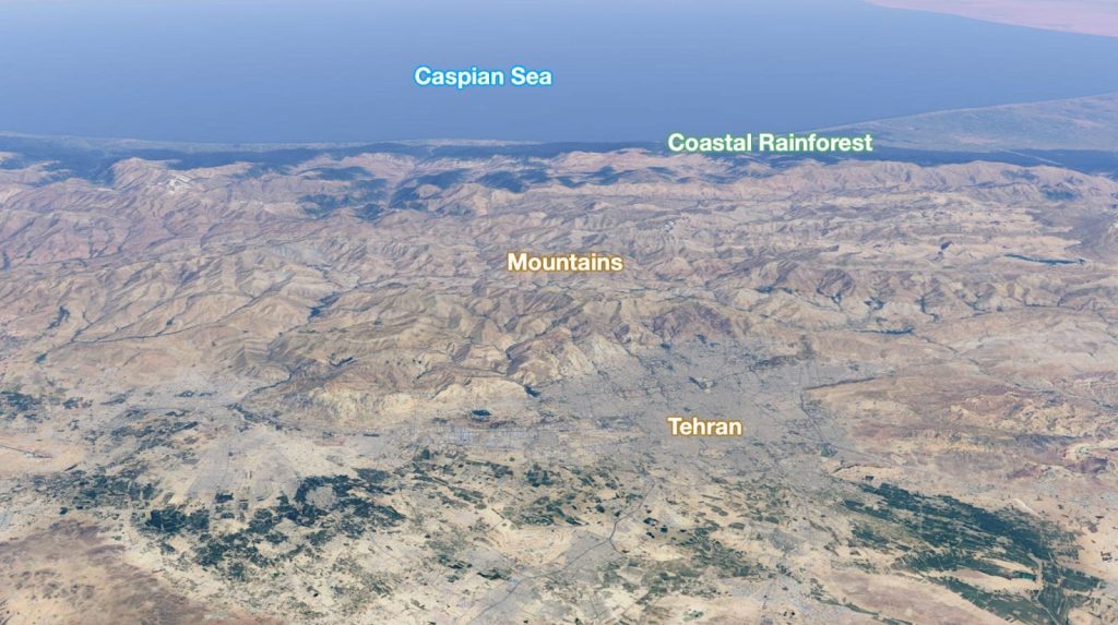
This makes the mountains there the best place to live. The temperature is much more pleasant at high altitudes, and the mountains capture water from the wind, which is necessary for agriculture and life. The location of Tehran, the capital of Iran, is therefore not surprising.
Photo: Tomas Pueyo (The Rain Shadow Effect)
On the other hand, however, mountains mean poverty, as building any road infrastructure is an extremely expensive process. Transport costs are therefore extremely high. And trade is extremely sensitive to them. Mountains thus mean little trade and little wealth creation. We can see something similar in Mexico and Brazil. Iran is structurally poor.
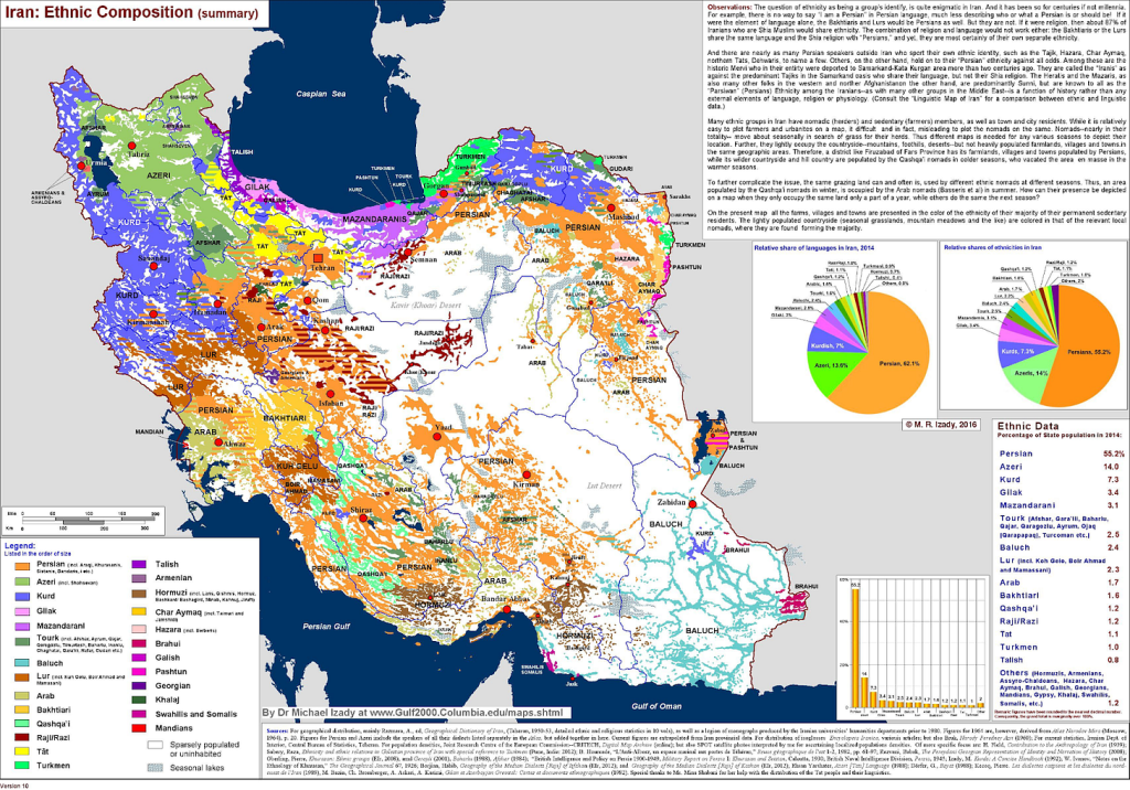
Another consequence of high transportation costs and low levels of trade caused by mountains is that communities remain separated, which leads to ethnic diversity – balkanization. Iran is a very diverse country.
Persians make up about 60 percent of the population, mostly in mountainous areas. However, the entire periphery is dotted with other ethnic groups. Azerbaijanis make up about 15 percent of the population and live mainly in the northwest. Interestingly, there are more Azerbaijanis living in Iran than in Azerbaijan itself.
Photo: Reddit
The southwest of the country, where the so-called Khuzestan Plain is located, is particularly interesting. There are several reasons for this.
First, it is part of Mesopotamia. Second, the local inhabitants are Arabs, similar to Iraqis. And third, most of Iran's oil fields are located here. The country is the third largest reservoir of black gold and even the second largest in terms of gas.
The country's problems are exacerbated by religion, as most Iranians are Shiites, but the Kurds, Baluchis, and several other nations are Sunnis.
Historically, the only way to solve these problems has been through broad autonomy.
This is what you find today in countries such as Switzerland. However, it is difficult to keep such a diverse country united. It often descends into violence, as in the Balkans, Mexico, Afghanistan...
However, new technologies have brought many opportunities to control the population and suppress any reformist ideas, which today allows local leaders to keep the country united while centralizing power.
What Tehran wants
Iran currently has five main priorities.
Its central location and the fact that it is surrounded by so many powerful countries force it to secure its borders. Looking at a map of its territory, it is clear that it is succeeding in this.
Another priority is unity. The core of Iran is predominantly made up of Persian-speaking Shiite Persians. However, its periphery is occupied by minorities living in neighboring countries. Iran can remain stable, but only as long as its security apparatus can demonstrate its power. If its position weakens, the country's future will be uncertain.
Foreign powers are, of course, aware of this. American involvement in the Middle East posed a serious risk to Iran. With its presence in Iraq to the west, Afghanistan to the east, and its alliance with Pakistan to the southeast, the US essentially surrounded Iran. During its involvement in the region, it supported separatist movements in Arab Khuzestan, Kurdistan, and Baluchistan.
Iran's third priority is therefore freedom from external influences. This includes not only the US, but also Russia, Turkey, and Saudi Arabia.
In addition, generating revenue for the state treasury is extremely important for Iran. Iran wants to trade its oil internationally, but its efforts are undermined by US sanctions imposed because of Iran's nuclear weapons program.
The final priority is to demonstrate power. Iran would like to return to its glory days when its influence extended to the Mediterranean Sea. This is one of the reasons why it had representatives in Iraq, Syria, Lebanon, and Gaza. However, some of the militias supported by Iran have been essentially eliminated by Israel over the past two years. Syria, in turn, fell mainly due to Turkish support. Its influence is therefore only noticeable in Iraq.
Tehran is currently extremely weakened and can hardly compete with Israel, which is backed by the United States, for the position of superpower in the Middle East. Its restrained response to last year's US bombing only confirms this.
Here is placeholder for Article excerpt Here is placeholder for Article excerpt Here is placeholder for Article excerpt Here is placeholder for Article excerpt
Here is placeholder for Article excerpt Here is placeholder for Article excerpt Here is placeholder for Article excerpt Here is placeholder for Article excerpt
Here is placeholder for Article excerpt Here is placeholder for Article excerpt Here is placeholder for Article excerpt Here is placeholder for Article excerpt
Welcome to the comments section of the Štandard daily. Please take note of our guidelines, comments are moderated by us. You can contact the moderators at [email protected].
Participate in the discussion
Comments are available to subscribers only. If you'd like to join the discussion, choose a subscription starting at €6.72 per month.
All comments 0
Register
Comments are available to registered users only. If you'd like to join the discussion, register here.